Datasets
Earth Engine’s public data catalog includes a variety of standard Earth science raster datasets. You can import these datasets into your script environment with a single click. You can also upload your own raster data or vector data for private use or sharing in your scripts.
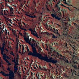
Landsat
Landsat, a joint program of the USGS and NASA, has been observing the Earth continuously from 1972 through the present day. Today the Landsat satellites image the entire Earth's surface at a 30-meter resolution about once every two weeks, including multispectral and thermal data. Earth Engine makes this data available in its raw form, as TOA-corrected reflectance, and in various ready-to-use computed products such as NDVI and EVI vegetation indices.
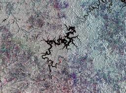
Sentinel
ESA’s Sentinel-1 mission uses radar to image the Earth in all weather conditions, even at night.The satellites capture C-band synthetic aperture radar (SAR) image data at 30- to 120-meter resolution in several polarization modes. Earth Engine includes a growing collection of Sentinel-1 data preprocessed using the Sentinel 1 Toolbox.
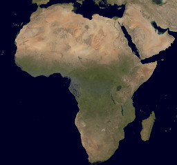
MODIS
The Moderate Resolution Imaging Spectroradiometer (MODIS) sensors on NASA's Terra and Aqua satellites have been acquiring images of the Earth daily since 1999. The Earth Engine catalog includes a variety of data products that NASA produces from MODIS data, including daily imagery, 16-day BRDF-adjusted surface reflectance, and derived products such as vegetation indices and snow cover.
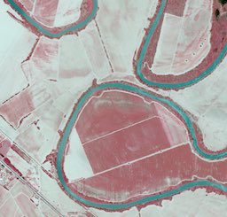
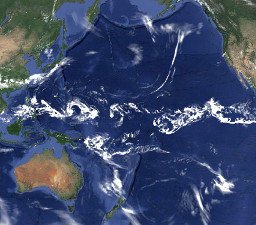
High-Resolution Imagery
High-resolution imagery captures the finer details of landscapes and urban environments. The US National Agriculture Imagery Program (NAIP) offers aerial image data of the US at one-meter resolution, including nearly complete coverage every several years since 2003. Earth Engine includes this data as well as sample imagery from several commercial providers.
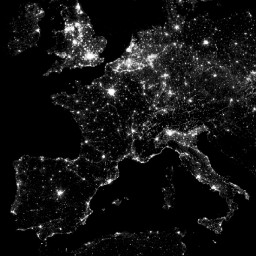
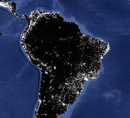
Other Imagery Data
Data from other satellite image sensors is available in Earth Engine as well, including night-time imagery from the Defense Meteorological Satellite Program's Operational Linescan System (DMSP-OLS), which has collected imagery of night-time lights at approximately 1-kilometer resolution continuously since 1992.
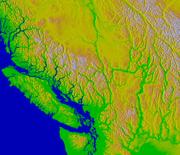
Terrain
Digital Elevation Models (DEMs) describe the shape of Earth’s terrain. The Earth Engine data catalog contains several global DEMs such as Shuttle Radar Topography Mission (SRTM) data at 30-meter resolution, regional DEMs at higher resolutions, and derived products such as the WWF's HydroSHEDS hydrology database.
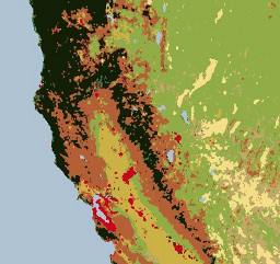
Land Cover
Land cover maps describe the physical landscape in terms of land cover classes such as forest, grassland, and water. Earth Engine includes a wide variety land cover datasets, including global products such as NASA's MODIS-derived annual land cover maps and ESA's GlobCover, as well as higher-resolution national products such as the USGS National Land Cover Database.
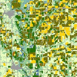
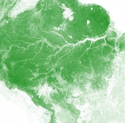
Cropland
Cropland data is key to understanding global water consumption and agricultural production. Earth Engine includes a number of cropland data products such as the USDA NASS Cropland Data Layers, as well as layers from the Global Food Security-Support Analysis Data (GFSAD) including cropland extent, crop dominance, and watering sources.
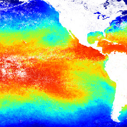
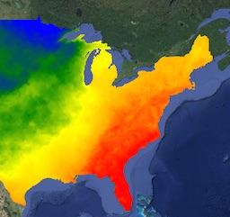
Surface Temperature
Thermal satellite sensors can provide surface temperature and emissivity information. The Earth Engine data catalog includes both land and sea surface temperature products derived from several spacecraft sensors, including MODIS, ASTER, and AVHRR, in addition to raw Landsat thermal data.
Other Geophysical Data
Other geophysical datasets available in Earth Engine include global forest change, biomass estimates, burned areas, and vegetation continuous fields. Alert-driven datasets include Fire Information for Resource Management System (FIRMS) and Global Forest Watch’s FORMA deforestation alerts.
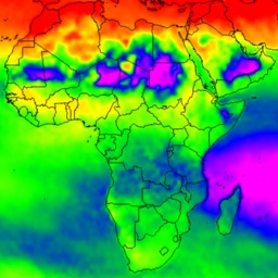
Atmospheric Data
You can use atmospheric data to help correct image data from other sensors, or you can study it in its own right. The Earth Engine catalog includes atmospheric datasets such as ozone data from NASA's TOMS and OMI instruments and the MODIS Monthly Gridded Atmospheric Product.
Weather
Weather datasets describe forecasted and measured conditions over short periods of time, including precipitation, temperature, humidity, and wind, and other variables. Earth Engine includes forecast data from NOAA's Global Forecast System (GFS) and the NCEP Climate Forecast System (CFSv2), as well as sensor data from sources like the Tropical Rainfall Measuring Mission (TRMM).
Climate
Climate models generate both long-term climate predictions and historical interpolations of surface variables. The Earth Engine catalog includes historical reanalysis data from NCEP/NCAR, gridded meteorological datasets like NLDAS-2, and GridMET, and climate model outputs like the University of Idaho MACAv2-METDATA and the NASA Earth Exchange’s Downscaled Climate Projections.
WorldPop
Population density is key to understanding the relationship between humanity and the environment. The Earth Engine data catalog includes WorldPop estimated population density data covering much of the world, including South America, Africa, and Southeast Asia, at various points in time.
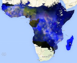
Malaria Data
Earth Engine also includes data produced by the Oxford Malaria Atlas Project that captures the incidence and prevalence of Pf malaria in Africa, the deployment of various interventions over time, and a set of global covariates that can be used for parasite modeling and risk mapping.